


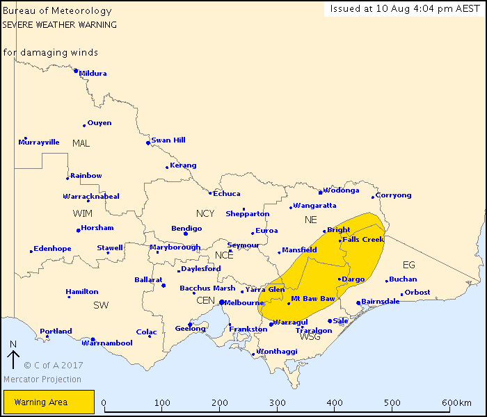
A large chunk of Baw Baw has been warned of damaging winds in a Bureau of Meteorology severe weather warning.
The information below and the map above are from the BoM at 4.04 pm today. Visit the BoM website for the latest information.
ADVERTISEMENT
Weather Situation:
North to northwesterly winds ahead of a cold front moving over Victoria this afternoon and evening.
DAMAGING WINDS, averaging 50 to 70 km/h with peak gusts of about 100 km/h are possible over the ranges. These winds are expected to continue to ease from the west during this afternoon and evening.
Locations which may be affected include Falls Creek, Mt Hotham, Mt Buller and Omeo.
Severe weather is no longer occurring in the South West and North Central districts and the warning for these districts is CANCELLED.
ADVERTISEMENT
Strongest wind gusts observed to 4 pm Thursday:
- Mt William 105km/h at 1.57 am,
- Mt Hotham 102 km/h at 11.15 am,
- Melbourne Airport 98km/h at 1.09 am,
- Kilmore Gap 94km/h at 4.10 am,
- Aireys Inlet 93km/h at 10.07 am.
The State Emergency Service advises that people should:
- Move vehicles under cover or away from trees;
- Secure or put away loose items around your house, yard and balcony;
- Keep clear of fallen power lines.
The next Severe Weather Warning will be issued by 11.00 pm AEST Thursday.


