


Winds have picked up in Baw Baw ahead of a potential severe thunderstorm later today.
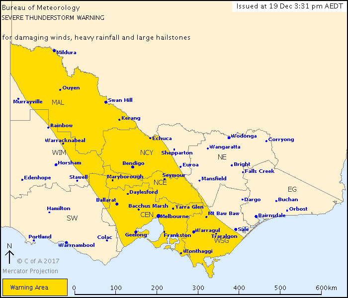
“Severe thunderstorms are likely to produce damaging winds, heavy rainfall that may lead to flash flooding and large hailstones in the warning area over the next several hours,” a Bureau of Meteorology spokesperson said in a warning message issued at 3.31pm.
“Locations which may be affected include Mildura, Bendigo, Seymour, Maryborough, Ballarat, Geelong, Melbourne and Traralgon.
ADVERTISEMENT
“Mildura has recorded a wind gust of 89km/hr at 3:01pm.
“The State Emergency Service advises that people should:
- “Move vehicles under cover or away from trees,
- “Secure or put away loose items around your house, yard and balcony,
- “Keep clear of fallen power lines,
- “Keep clear of creeks and storm drains,
- “Don’t drive, ride or walk through flood water,
- “Be aware that in fire affected areas, rainfall run-off into waterways may contain debris such as ash, soil, trees and rocks,
- “Be alert that in areas recently affected by fires, heavy rainfall increases the potential for landslides and debris across roads,
- “Stay indoors if possible,
- “Avoid using the phone during the storm,
- “If you are outside, avoid sheltering under trees,
- “Listen to the radio for storm updates, [and]
- “Switch off your computer and electrical appliances.”
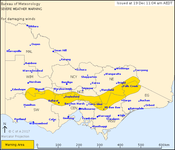
A separate severe weather warning issued this morning for damaging winds averaging 50 to 60km/h with peak gusts between 90 and 100km/h remains in place. The warning area covers a small amount of northern Baw Baw.
ADVERTISEMENT
The next scheduled BoM warning will be issued at 6.35pm or sooner. Visit the BoM website for the latest warning information.


